Tuesday, November 5, 2013

Canyonlands - Island in the Sky

Saturday, November 2 and Sunday, November 3, 2013


Yesterday and today we experienced more of this unique area. We visited Canyonlands National Park eleven years ago in a tent, with our then 17 year old daughter. It was July and over 100 degrees. We had a few quick hikes and retreated at night to a campground at 10,000 feet in the Manti-La Sal National Forest to get cool.


This time we were able to get into the tiny Willow Flats Campground in the park. Before leaving nearby Dead Horse Point, we filled extra water jugs and dumped our tanks. Willow Flats has no amenities, but is a lovely park near the Green River overlook. We arrived early enough in the morning to snag a spot in this popular campground. We registered, a deal at $10 a night, we paid $25 at Dead Horse Point, had lunch, and then drove out to Grand View Point at the end of the Island in the Sky peninsula. Canyonlands NP consists of three separate areas, Island in the Sky, The Needles, and The Maze which are below us and inaccessible from the park roads. Both areas require long detours to travel to them.


The Grand View Point trail took us along the rim looking thousands of feet below us to the canyons carved by the Colorado and Green Rivers. The view is similar to Dead Horse Point but different as we were hiking farther west of there. We stood on large stone ledges jutting out into the void above sheer cliffs and gazed at amazing mesas, buttes, spires, canyons and the meandering canyons formed by the rivers, so deep that we couldn't see the water!

Grand View Rim Trail

Unfortunately, no camping here! Can you spot Greg?


Looking down on the Colorado River, The White Rim trail follows the edge where the White Rim sandstone is exposed.

Kayenta sandstone cliffs. Can you spot the rig at the top of the cliff?

Mormon Tea?


Fierce Wildlife - when he grows up, he will be 3 whole inches long!

Tour guide

We could see the tiny ribbons of dirt roads and a few bug sized Jeeps venturing out on them. Following them with our binoculars, we watched their slow progress over the vast plateaus. Greg's dream had been to bike the White Rim Trail below us, a three day endeavor, camping as you go. I would drive a Jeep following him. Eleven years later, with the wisdom of our older selves, we decided to take that one off the Bucket List!
Realizing that we were getting low on propane, we had a good meal last night, bundled up, streamed some video, (Thankfully our MIFI with the amplifier helps us get a signal), and crawled under the down comforter, ready for a cold night, with no heat, to conserve the propane. Surprise! It only got into the 50's. We were plenty warm.

This morning Greg did a short hike down to the Green River overlook and explored the area.


After lunch we drove to Upheaval Dome and took a hike there. It is a bizarre crater that the geologists aren't sure how it was created. I'll let Greg give a brief explanation-

Upheaval Dome is a basin about 3 miles in diameter and maybe 2,00 feet deep. It consists of the same rocks as the surrounding area but where the neighboring rocks are flat lying for tens of miles, the dome consists of a ring of downward-folded rocks (a syncline) surrounded by a ring of upward folded rocks (an anticline). The rocks in the basin core are twisted into tight folds and a wildly contorted center spire. The National Park Service info boards simply state that there are two theories for the creation of Upheaval Dome: a meteorite impact or the rise and subsequent collapse of a salt dome from the underying Paradox formation (of petroleum fame). Greg favored the salt dome theory because of the folding of the otherwise brittle sandstones and the mining of a salt dome a few miles away below Deadhorse Point. Later, he downloaded a geologic paper from NASA that provided pretty convincing evidence that Upheaval Dome is the result of a meteorite impact.


View across Upheaval Dome


Contorted Rocks in the crater bottom.

Lichen on slickrock (Navajo formation)


The trail wasn't more than a mile long and went to two overlooks above the crater, but the hike required a lot of scrambling across slickrock, which is steep, but not really slick if you are wearing a good pair of hiking boots. We did wind up on top of some large rounded areas, high up and very windy! The weather had begun turning. The sun was still out as we made our way back, but the wind was getting brisker.


Steps cut into the slickrock


Another view into the side of Upheaval Dome


View of the RV from near the trailhead


After returning to our campsite, the wind and rain started. We are sitting in near darkness, since the time change occurred last night as well. Time to get out all the battery powered lights and bundle up while I make dinner. The temperature has dropped from the 60's to the 40's in the last hour.

Squall moving in

Raining here, sunny there

Tomorrow we'll head into Moab and take care of chores, laundry, groceries, and so forth, so we will be ready to head south to warmer climes. We'll save the rest of southern Utah for warmer weather. Tomorrow night we'll spring for a private campground and catch up on “luxury”!

Dead Horse Point State Park

Thursday, October 31 and Friday, November 1, 2013


Thursday morning we finished the drive to Dead Horse Point and found a site for the next two nights. Perfect timing! They had a dump, and a place to fill our jugs, plus electricity. After settling in to a very nice, level spot, we hiked from the campground, five miles around the Rim Trail.


Dead Horse camp site

Dead Horse Point is a peninsula with a narrow neck, looking over the canyonlands created by the Colorado and Green Rivers. There are spectacular views in all directions. The name derives from a story of cowboys rounding up wild mustang horses. Because the sides are so steep, they could corral them by building a fence across the 30 foot neck, and contain them while they chose the ones they wanted. Apparently, one time they didn't let the rest of the horses go free, and they died of thirst within view of the river. A sad story for such a stunning spot.

Looking toward the Colorado River from Dead Horse Point


Greg communing with a raven!


We hiked the rim from the campground, around to the end and back the other side. Check out the photos for a glimpse of what we saw. Unfortunately, this area is probably always hazy due to pollution drifting up from Las Vegas and coal-fired power plants. The Grand Canyon suffers the same problem. It still is a view that has to be seen in person to really appreciate it.


Friday morning Greg decided to take his mountain bike off the rack and try out the bike trails in the park. It was his first experience with off roading here, and his first time on some of the famous Moab slickrock bike trails. He said it was slow going at first, but then he got his “mojo” back and started to enjoy it! I stayed in camp to enjoy a down day and watched the ravens try to find food scraps from our grill. Greg used our new and first ever, grill the night before, on our covered patio at our campsite. Yummy dinner!

Greg with Big Manly Grill

Every campsite came with fly-in cleaning service

It was nice to have electricity to run the heater both nights as we had near freezing temperatures. The RV has no insulation. The manufacturers don't design them for fulltime or year round living, so we make do. We have a built-in propane furnace, but it is annoying as it cuts on and off all night. Besides, if we are already paying to have electric service at our site, we might as well use the portable heater.

After Greg's ride we decided a week was too long to go without a real shower. Unless you stay at a very pricey campground in Moab, you have to bring your water with you to the campground. So, you tend to get really good at water conservation strategy, using it and disposing of it. You might still have water, but if your waste tanks are full, you have a problem. The campsites also do not have dumps. Dead Horse Point has a dump station, and a faucet to fill our five gallon jugs. Greg then uses the winterizing siphon to get the water into the water tank, since there is no faucet in the camp to hook up a hose. The campgrounds don't have showers, so Greg filled up our 27 gallon tank from the five gallon jugs of water that he hauled from the campground sink. We deconstructed our shower, which has removable shelves and we use for storage, and we proceeded to turn on the hot water heater, and take Navy showers. Get wet, turn off the water, lather up, turn on the water, and rinse off. Between the two of us we showered with about 10 gallons of water. Not a luxurious soak, but it felt great to be clean and have clean hair!

After a shower, a good meal and a peaceful nights sleep, we were ready the next day to see Canyonlands National Park!

Negro Bill Canyon and Morning Glory Natural Bridge

Tuesday, October 29, 2013 and Wednesday, October 30, 2013


Tuesday morning looked like it could be a decent day, but had a chance of showers in the afternoon, so we packed up our campsite and decided to find a hike. First we drove up the highway along the river and away from Moab towards Fisher Towers. When we arrived there we decided not to drive the 2.2 miles up the dirt road to the trailhead. After heavy rains the night before, the roads looked very wet and muddy, so we drove back past our campsite to a trailhead close to town, at Negro Bill Canyon. That trailhead has a paved parking lot, so we found a spot and started a hike up the canyon to the Morning Glory Natural Bridge. It's the 6th largest natural bridge in North America.

Fisher Towers in the distance

Looking up the Castle Rock canyon toward the La Sal mountains

Route 128 down the Colorado River Canyon


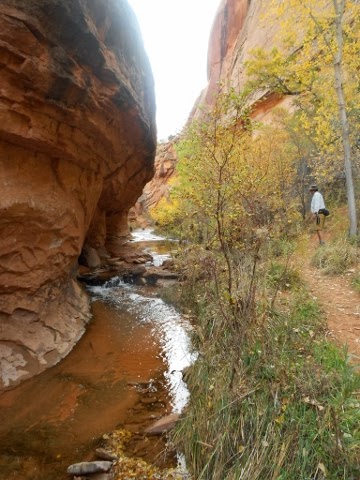
The trail into the canyon followed a year round stream, rare for these parts. We had to cross it a half dozen times before heading up a side canyon to the bridge. The bridge was so large that I couldn't get far enough away, even with a wide-angle lens, to capture it in one shot. A stream flowed out of the rock on the side of the canyon walls filling a small pond. The acoustics under the arch amplified our voices.


Hiking up Negro Bill Canyon


One of many stream crossings


Morning Glory Natural Bridge


Under the bridge we met Craig with his four dogs. He lives in his van and is a kite surfer who spends summers in Bend, Oregon and winters in Baja, Mexico. His dogs had all been strays and 3 of them he found in Mexico. They enjoyed being petted while we talked with their owner.

Craig and canines


We didn't stay very long at the bridge and began our hike back as the clouds started to build, because we didn't want to be fording streams during a rainstorm. It stayed dry until we returned to the rig. We drove over to Arches National Park, which is just a few miles from town, but their campground was full. They were taking reservations until November 1st, when they go first come-first served. Since the weekend rush was over in the BLM campgrounds along the river, we were able to get into a riverfront site for the night in Goose Island Campground, the closest to town.


It started raining as we arrived, and continued on and off during the night with strong winds. No chance for us to sit along the river and enjoy the view! The next morning after the rain stopped we drove back to Arches, but unless we were willing to make the drive 18 miles into the park to see if anyone had left early on their reservation, they considered the campground full. We decided to save the fuel and wait until after November 1st, so we drove on up the road to the turnoff for Canyonlands National Park and Dead Horse Point State Park. The state park website showed that there were a few openings for the next few nights before the weekend, but would be full over the weekend, so we thought we'd try there.

You might wonder why we don't make reservations ahead of time. First of all, we want to be spontaneous. We've realized that both our personalities can handle it, some people can't, so we decide where we are going a few days ahead, or sometimes when Greg gets behind the wheel in the morning. Secondly, we try to visit places in the slow season to avoid crowds and crowded campgrounds. And , thirdly, the reservation systems for the public parks charge, pretty uniformly, at least $9 to make the reservation. That is on top of the camping fee! Only once have we been unable to get into a campground and we wound up in a WalMart parking lot. Since we are self-contained we always have other options.

After taking the turnoff to the state park we came upon a BLM campground called Horsethief. It was a large campground on a plateau at about 6,000' and almost empty. As usual there were no hook-ups, but we had driven into Moab after we left Goose Island and filled up two five gallon water jugs at Gearheads. They have a large indoor sink with several faucets and a sign that says to take all the free water you need. At Horsethief we picked out a secluded spot and watched the clouds and storms roll around us across the vistas. We took a short walk together around the campground and Greg found a trail that took him several miles through the surrounding countryside. I went back to the rig and warmed up! Then we watched a beautiful sunset together and retreated to the rig as the temperature began to drop. It was another cold night of near freezing temperatures. Thursday morning we would head for Dead Horse Point.

Filling up with water at Gearheads.

The view from Horsethief Campground